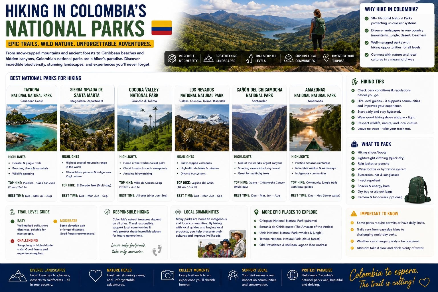
Beyond the Ciudad Perdida trek, Colombia’s national parks and protected areas offer a genuinely wide range of hiking, from an easy half-day walk to serious multi-day high-altitude trekking. This guide rounds up the best hiking available outside the Lost City trek, organised by region, with links to the fuller destination guides for each.
The Cocora Valley (Coffee Region)
The most accessible and most photographed hike on this list: a 4 to 5 hour loop through the wax palm-covered valley near Salento, reaching up to 2,900 metres but requiring no technical skill or serious fitness beyond a reasonable half-day walk. The single most-hiked trail in the Coffee Region and a near-mandatory stop for visitors to Salento. See the full Cocora Valley hiking guide for the detailed route breakdown.
Los Nevados National Natural Park
A high-altitude park spanning the border of the Quindío, Risaralda, Tolima, and Caldas departments, home to several snow-capped volcanic peaks including Nevado del Ruiz, Colombia’s most active volcano, and Nevado del Tolima. Hiking here ranges from moderate day hikes across páramo landscape (accessible from Salento or Manizales) to serious multi-day high-altitude routes toward the summits themselves, which require proper acclimatisation, appropriate equipment, and often a specialist guide given the altitude (much of the park sits above 4,000 metres) and the need to monitor current volcanic activity status before planning any route close to Nevado del Ruiz.
El Cocuy National Natural Park
Colombia’s most serious trekking destination for experienced hikers: a remote park in the Boyacá department containing the largest concentration of glaciers and snow-capped peaks in Colombia outside the Sierra Nevada de Santa Marta. Multi-day treks here (typically 3 to 5 days) reach altitudes above 4,500 metres, cross genuinely challenging terrain, and require proper cold-weather equipment, acclimatisation, and, in most cases, a local guide, since some routes cross indigenous U’wa territory with specific access protocols. This is not a hike for casual visitors; it is a serious undertaking for experienced trekkers specifically seeking Colombia’s highest and most demanding terrain, and it sees a small fraction of the visitor numbers that the Cocora Valley or even Ciudad Perdida receive as a result.
Tayrona National Park
Tayrona combines beach and jungle hiking rather than mountain trekking: trails connect a series of beaches along the Caribbean coast near Santa Marta, ranging from a straightforward 1 to 2 hour walk to the most accessible beaches to longer half-day routes reaching more remote coves. The hiking itself is easy by the standards of this list; the appeal is the combination of jungle canopy, coastal scenery, and beach access rather than physical challenge or altitude. See the Santa Marta guide for the practical Tayrona visiting details.
The Sierra Nevada de Santa Marta (Beyond Ciudad Perdida)
Beyond the Lost City trek itself, the wider Sierra Nevada de Santa Marta, the world’s highest coastal mountain range, offers additional hiking around Minca and further into the range for visitors with more time, much of it overlapping with the birdwatching opportunities in the same area given the exceptional ecological diversity of this specific mountain range.
Choosing Between Them
For a first-time visitor with limited time: the Cocora Valley is the easy, high-reward choice, requiring no special planning or fitness beyond a normal half-day walk. For visitors specifically seeking a serious multi-day trekking challenge: El Cocuy is the most demanding and most rewarding option, but requires real preparation and is not a spontaneous add-on to a broader Colombia trip. For a beach-and-jungle combination requiring minimal hiking fitness: Tayrona. Los Nevados sits between these: accessible day-hike options for casual visitors, serious summit routes for those who want them.
Preparation and Safety
Altitude matters more than distance for most of the routes on this page: Los Nevados and El Cocuy both involve genuine high-altitude exposure, and proper acclimatisation (spending a night or two at moderate altitude, such as in Manizales or Bogotá, before attempting a high-altitude route) reduces the real risk of altitude sickness. Weather in all of these parks can change quickly and significantly; layers, a proper rain jacket, and checking current conditions with a local guide or operator before setting out are standard practice rather than excessive caution. See the packing guide and vaccinations guide for the wider preparation picture.
Related: Ciudad Perdida Trek | Coffee Region Hub | Cocora Valley Hiking Guide | Santa Marta and Tayrona
For corrections or updates to this guide: contact@allaboutcolombia.com.